




For years, satellite intelligence was treated as a specialized capability largely associated with national security, military ISR, or highly technical geospatial workflows. That distinction is fading quickly. In many sectors, space-enabled intelligence is becoming operational infrastructure: a system organizations increasingly depend on to validate activity, assess risk, and maintain continuity in environments where traditional signals can no longer be fully trusted.

CEO and Chairman at Privateer Space
Few places demonstrate that shift more clearly than the Strait of Hormuz.
Roughly a quarter of the world’s seaborne oil trade and around one-fifth of global LNG trade passes through this narrow maritime corridor. At its tightest point, the Strait narrows to roughly 29 nautical miles, leaving few viable alternatives capable of supporting comparable global energy flows. When disruption occurs in Hormuz, the consequences move quickly through shipping markets, insurance pricing, logistics networks, commodity trading, and broader economic systems.
What makes the current environment especially important is that the disruption is no longer limited to physical or kinetic threats alone.
Recent advisories from UKMTO and JMIC have highlighted a growing pattern of GNSS spoofing, AIS anomalies, electronic interference, increased naval activity, and broader degradation of maritime situational awareness throughout the Arabian Gulf, Gulf of Oman, and Strait of Hormuz. Increasingly operators are confronting an environment where self-reported vessel positioning and identity data cannot always be independently trusted without external validation.
The operating challenge in Hormuz is increasingly about degraded trust in the information environment itself.
Once vessel positioning, identity signals, or declared activity become unreliable, every downstream operational decision becomes more difficult and more expensive. Commercial operators may struggle to validate routes or cargo movement. Insurers face greater uncertainty in underwriting risk exposure. Ports and terminals must evaluate disruptions with incomplete visibility. Commodity traders, shipping companies, and governments are all forced to make higher-stakes decisions in environments where confidence in the underlying data has weakened.
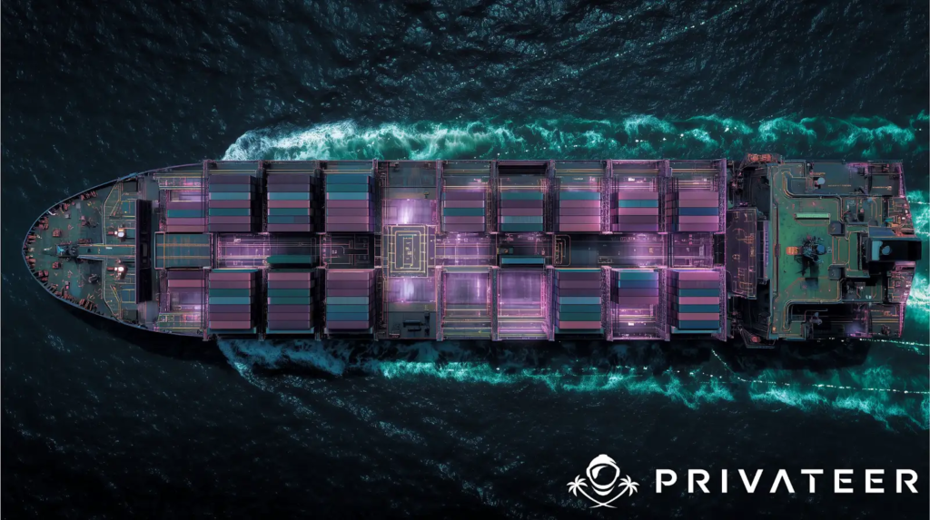
This is where Earth intelligence is rapidly becoming operationally indispensable.
Optical imagery provides visibility into what is physically present. Synthetic Aperture Radar (SAR) enables monitoring through cloud cover, darkness and adverse weather conditions.
Space-based AIS expands vessel visibility beyond the limitations of terrestrial receivers. RF geolocation and signal intelligence layers can further assist in validating activity independently of transponder-based reporting. Increasingly, the real value emerges from the ability to fuse these sources together and identify inconsistencies between declared and observed behaviour, detect spoofing or dark-vessel activity and surface behavioural patterns that would otherwise remain hidden.
That shift matters because the challenge is no longer simply collecting imagery or receiving signals. The challenge is validating reality and resolving ambiguity quickly enough to support operational decisions in environments where the individual data feeds may be degraded, manipulated or incomplete.
In many ways, this represents the evolution of dual-use capability into something broader and more commercially embedded. The same fused intelligence architecture can simultaneously support maritime security operations, insurance underwriting, energy logistics, port management, supply chain resilience, environmental monitoring, and strategic trade analysis. Different stakeholders may reach different conclusions from the same data, but they increasingly rely on a shared operational intelligence layer to do so.
Hormuz illustrates this reality with unusual clarity.
When maritime chokepoints destabilize, the effects move rapidly through global trade systems. UNCTAD has repeatedly highlighted how disruptions in strategic waterways contribute to freight volatility, congestion, rerouting pressure, and wider supply chain instability. The World Economic Forum has also noted the growing strain placed on insurance markets as geopolitical risk increases across critical maritime corridors.
At the same time, commercial intelligence providers are now operating within the same decision environment historically associated with sovereign ISR systems. That does not mean commercial platforms are replacing government capabilities. It means strategic industries increasingly require persistent, evidence-based situational awareness to continue operating effectively in contested or uncertain environments.
The distinction between defense infrastructure and commercial infrastructure is becoming less rigid.
This transition is still understated in many mainstream conversations surrounding Earth observation. Much of the long-term economic value of EO systems is expected to emerge downstream, within operational industries rather than the satellite sector itself. Yet many organizations still treat Earth intelligence as a specialized analytical capability instead of an integrated operational function.
That mindset is changing.
Platforms such as Privateer’s Elements reflect a broader industry shift toward making fused Earth intelligence more accessible and operationally usable beyond traditional geospatial specialists. Rather than focusing solely on imagery collection, these systems increasingly aggregate satellite, terrestrial, and customer-provided data into unified operational environments capable of supporting vessel tracking, interference detection, supply chain analysis, infrastructure monitoring, environmental alerts, and risk assessment workflows.
The relevance of that model becomes especially apparent in places like Hormuz.
When spoofing, dark-vessel activity, electronic interference, or conflicting signals emerge, operators are rarely dealing with perfect information. Decisions must still be made despite incomplete visibility. In those scenarios, the ability to validate vessel activity and positioning across AIS, SAR, EO imagery, RF detections, and other independent sources becomes far more valuable than relying on any single feed or sensor alone.
That is why the future of Earth intelligence is increasingly centered on orchestration, cross-sensor validation, and decision confidence rather than raw data accumulation. The strategic advantage increasingly belongs to platforms capable not only of collecting information, but of verifying what is actually occurring within contested or degraded operational environments.
The Gulf Cooperation Council region is becoming one of the clearest examples of this transition from space ambition into operational capability.
The UAE continues expanding its Earth observation ecosystem through initiatives such as MBZ-SAT, Etihad-SAT, and the GIQ platform, which integrates imagery from hundreds of satellites across multiple providers. Saudi Arabia’s PIF-backed Neo Space Group recently completed the acquisition of UP42 while advancing the Kingdom’s ambitions around commercial EO accessibility and geospatial infrastructure. Oman’s OL-1 satellite reflects growing regional investment in AI-enabled Earth observation systems, while Qatar continues expanding its capabilities in communications and interference monitoring infrastructure.
Taken together, these developments represent something larger than a collection of isolated national projects.
The GCC is emerging as one of the first regions where sovereign investment, commercial Earth intelligence, maritime security requirements, energy infrastructure protection, and logistics modernization are converging into a broader operational ecosystem.

For a region so deeply tied to global trade flows, energy exports, and maritime continuity, the commercial incentives surrounding Earth intelligence are immediate and practical rather than purely aspirational.
This is no longer primarily about prestige programs or symbolic participation in the global space economy.
It is about building resilient operational infrastructure for an increasingly uncertain strategic environment.
The Strait of Hormuz may ultimately be remembered as more than a geopolitical flashpoint. It may also serve as one of the clearest demonstrations of how Earth intelligence is evolving into a foundational operating layer for global commerce, infrastructure, and strategic decision-making.
Organizations that operationalize this capability now will likely shape the next generation of resilience, logistics coordination, maritime awareness, and infrastructure security. Those that fail to adapt may find themselves increasingly dependent on fragmented visibility and secondhand interpretation during moments when clarity matters most.
In the coming decade, strategic advantage may belong less to the organizations with access to the most data and more to those capable of validating reality faster than everyone else.